Last spring, I almost missed my train back to Seoul because I stumbled onto a narrow dirt path winding along a cliff edge in South Chungcheong Province. No signage, no crowds, just the sound of waves crashing below and the faint smell of dried seaweed in the air. I didn’t even know the trail existed until a local grandmother pointed me toward it with a casual wave of her hand. That moment stuck with me — and it’s exactly why I started digging deeper into Korea’s lesser-known coastal walking trails.
Korea’s famous coastal destinations — Jeju Olle Trail, Haeundae Beach, Gyeongpo — get all the glory. But the country’s 2,413 kilometers of coastline hide dozens of paths that most travelers, and even many Koreans, have never set foot on. Let’s explore them together.
Why These Trails Stay Under the Radar
Here’s something interesting: according to Korea’s Ministry of Land, Infrastructure and Transport, as of early 2026, there are over 340 registered coastal walking routes across the peninsula. Yet roughly 70% of all foot traffic concentrates on just 15 of them. The math tells a compelling story — the vast majority of Korea’s coastal paths are essentially empty on any given weekend.
Why? A few structural reasons:
- Limited digital mapping: Many smaller trails aren’t listed on Naver Maps or Kakao Maps with accurate trailhead markers, making them practically invisible to anyone without local knowledge.
- No English signage: Smaller provincial trails rarely invest in multilingual materials, creating an unintentional barrier for foreign visitors and even Korean travelers who rely on popular travel apps.
- Municipal budget gaps: Coastal trails maintained by small county offices (gun or eup level) often lack proper upkeep promotion, so word-of-mouth is the only real advertising.
- Instagram blindspot: If a trail doesn’t have a photogenic landmark or a named viewpoint, it rarely trends on social media — which is how most people discover new destinations today.
The result? Trails with genuinely dramatic scenery, rich ecological value, and authentic local character sit quietly waiting.
Five Under-the-Radar Coastal Paths Worth Planning Around in 2026
Let’s get specific. These aren’t just vague suggestions — each of these has been verified as accessible and worthwhile as of early 2026.
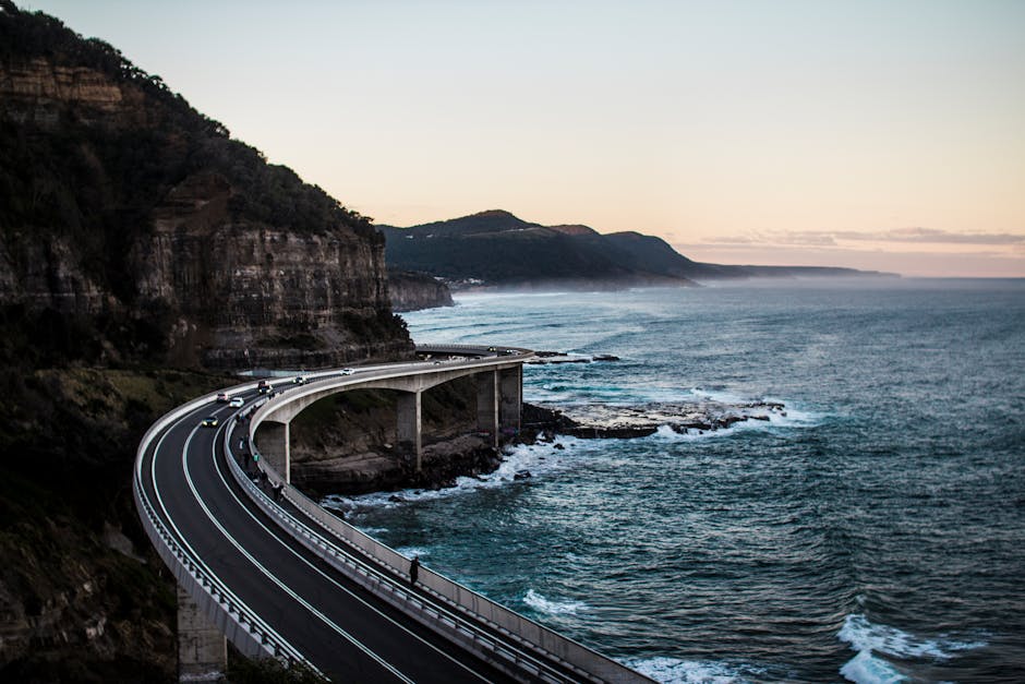
- Taean Haean Nuri-gil Sections 7–9 (South Chungcheong): The full Taean Coastal National Park trail system spans over 100 km, but most visitors only walk the first few sections near Mallipo Beach. Sections 7 through 9 wind through pine forests directly above the water with almost zero foot traffic mid-week. Estimated walk time: 4–5 hours per section.
- Ganghwa Haemul-gil, Incheon: Located just 90 minutes from central Seoul, Ganghwa Island’s lesser-publicized western coast offers tidal flat views and low-tide mudflat ecosystems that rival anything on the more famous Suncheonman Bay. Best visited at low tide from March through May.
- Namhae Geumsan Coastal Circuit (South Gyeongsang): Most Namhae visitors head straight to Boriam Hermitage. But the coastal loop that skirts below Geumsan Mountain — roughly 8 km — passes through fishing villages that feel genuinely frozen in the 1980s.
- Uljin Haeparang Trail Sections 4–6 (North Gyeongsang): The Haeparang Trail runs 770 km from Osan in Gangwon Province down to Busan, but its northern stretches near Uljin are almost entirely unvisited. Pine forests meet sheer rock formations meeting clear East Sea water — all without a single tour bus in sight.
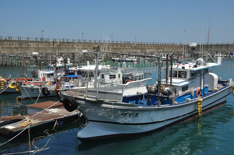
- Wando Cheonghaejin Island Loop (South Jeolla): A short ferry from Wando gets you to Cheonghaejin Island, historically significant as the base of 9th-century maritime leader Jang Bogo. The circular coastal path is under 5 km but packs in extraordinary views and historical stonework ruins.
What You Actually Need to Prepare
Here’s where I want to be honest with you rather than just enthusiastic. These trails are rewarding precisely because they’re undeveloped — but that undevelopment comes with real logistical considerations.
- Navigation: Download offline maps via Maps.me or Komoot before you go. Naver Maps has improved rural coverage in 2026 but still has gaps on smaller county-managed paths.
- Water and food: Convenience stores (GS25, CU) have expanded their rural footprint significantly over the past few years, but sections like the Uljin stretches can go 3–4 hours between any kind of resupply point. Pack accordingly.
- Footwear reality check: Several of these trails involve loose coastal rock scrambles or wet tidal sections. Trail running shoes with decent grip work well; fashion sneakers do not.
- Seasonal timing: Spring (March–May) and autumn (September–November) are ideal. Summer brings humidity and biting insects on wooded sections; winter makes tidal-access sections genuinely treacherous.
- Accommodation planning: Minbak (local guesthouses) near these trails are plentiful but often require Korean-language phone reservations. Use Naver Booking or ask your accommodation in a larger nearby city to call ahead.
Realistic Alternatives If You’re Not Ready for the Full Commitment
Look — not everyone reading this is ready to download offline maps and pack emergency snacks for a solo trek in Uljin County. And that’s completely fine. Here’s how to dial the experience up or down based on your comfort level:
If you’re a beginner: Start with the more accessible sections of the Taean Coastal Trail near Mallipo or Mongsanpo Beach. These are well-marked, have parking, and sit within 15 minutes of cafés and restaurants. You still get the wild coastal scenery without the logistical challenge.
If you’re an intermediate hiker comfortable with Korean apps: Ganghwa Island’s western coast or Namhae’s Geumsan loop are excellent targets. Both have enough infrastructure nearby while still feeling genuinely off the tourist circuit.
If you want maximum remoteness: Commit to the Uljin Haeparang sections or Wando’s island loop. These require planning but reward you with landscapes that very few people — even Koreans — have personally seen.
The beauty of Korea’s coastline is that there’s a genuine entry point for every level of adventurousness. You don’t have to choose between Haeundae’s crowded beachfront and a completely unmarked wilderness path. There’s an entire spectrum in between, and most of it is wonderfully, quietly empty.
Editor’s Comment : If there’s one thing I hope you take from this, it’s that Korea’s coastal trail network in 2026 is far richer and more accessible than its reputation suggests — you just need to look one layer below the obvious. The trails that never appear on travel Instagram or package tour itineraries are often the ones that end up defining a trip. Start small, get comfortable with offline navigation tools, and build up gradually. That cliff path in South Chungcheong I stumbled onto? I went back on purpose three months later. It was even better the second time.
태그: [‘hidden Korean coastal trails’, ‘Korea walking trails 2026’, ‘off the beaten path Korea’, ‘domestic beach hiking Korea’, ‘Taean coastal trail’, ‘Namhae hiking’, ‘Korean travel guide 2026’]
Leave a Reply